 GeoData.NZ
UNDERWATER VIDEO CAMERA
Type of resources
Topics
Keywords
Contact for the resource
Provided by
Years
Update frequencies
status
-
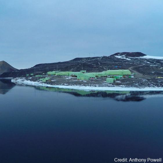
As part of the Scott Base Redevelopment Marine Monitoring Programme, the impact of Scott Base's activities on the local marine environment was assessed. Sampling took place at three sites around Hut Point Peninsula on the southern half of Ross Island during October – November 2019 to assess anthropogenic contamination. Two acoustic doppler current profilers (ADCP; Nortek Signature 500) were deployed, and set with a 2-minute sampling period in 1m vertical depth bins from the seabed to the underside of the ice. Instrument heads were kept ~0.5 m beneath the under-surface. ADCP data were downloaded, extracted from their raw formats, and averaged into 10-minute intervals. A magnetic declination of 141.09° E was applied to the measured current direction to correct the readings to reflect true north and a pressure offset was applied to standardise depths relative to ambient air pressure at the seawater surface. Information on habitats and benthic epifauna assemblage composition were collected using high resolution video across 2 25m transects at ~22m depth. Multiple overlapping passes were made across the seabed transects at ~0.5 m depth contours between ~20 – 26 m in order to create a 2D orthomosaic image of each site. Analysis of the diver-collected video was done using individual frames. The video along each transect was divided into 10 equal time segments and still frames were taken at random from the first, third, fifth, seventh and ninth segments. Eight video frames were analysed per transect (i.e., n=8 per transect and n=16 per site) by one individual to minimise observer bias. Sediment samples were collected by divers to determine contaminant concentrations and sediment characteristics (sediment particle size composition, organic matter content, organic carbon content and algal pigment content) at each site. Sponge species (Sphaerotylus antarcticus and Laternula elliptica) were collected for tissue contaminant analysis. Full description of methods is available at: https://doi.org/10.1007/s00300-023-03181-1 GET DATA: drew.lohrer@niwa.co.nz
-
Data includes estimates of abundance of seaweed taxa on the seafloor across the Northern Victoria Land coast, Ross Sea, Antarctica. This includes: - Metadata of video transects - Seaweed density across transects - Modelled outputs of light attenuation across sites. Descriptions: - "Antarctic_Seaweed_Metadata_TAN2101_TAN2302_Dryad.xlsx" - Metadata of video transects, date and time, locations, gear, depth, distance covered. - "Antarctic_Seaweeds_TAN2101_TAN2302.csv" - Density of seaweed functional groups across video transects - "Light_transects_TAN2021_TAN2302.csv" - Outputs of light modelling for seafloor regions of the Ross Sea - "Antarctic_Seaweed_RScript_Tait_etal_2024.txt" - R sripts used to plot, analyse and model the above datasets Further details are provided at: Tait, L.W., Chin, C., Nelson, W. et al. Deep-living and diverse Antarctic seaweeds as potentially important contributors to global carbon fixation. Commun Earth Environ 5, 205 (2024). https://doi.org/10.1038/s43247-024-01362-2 GET DATA: https://doi.org/10.5061/dryad.w6m905qwz
-
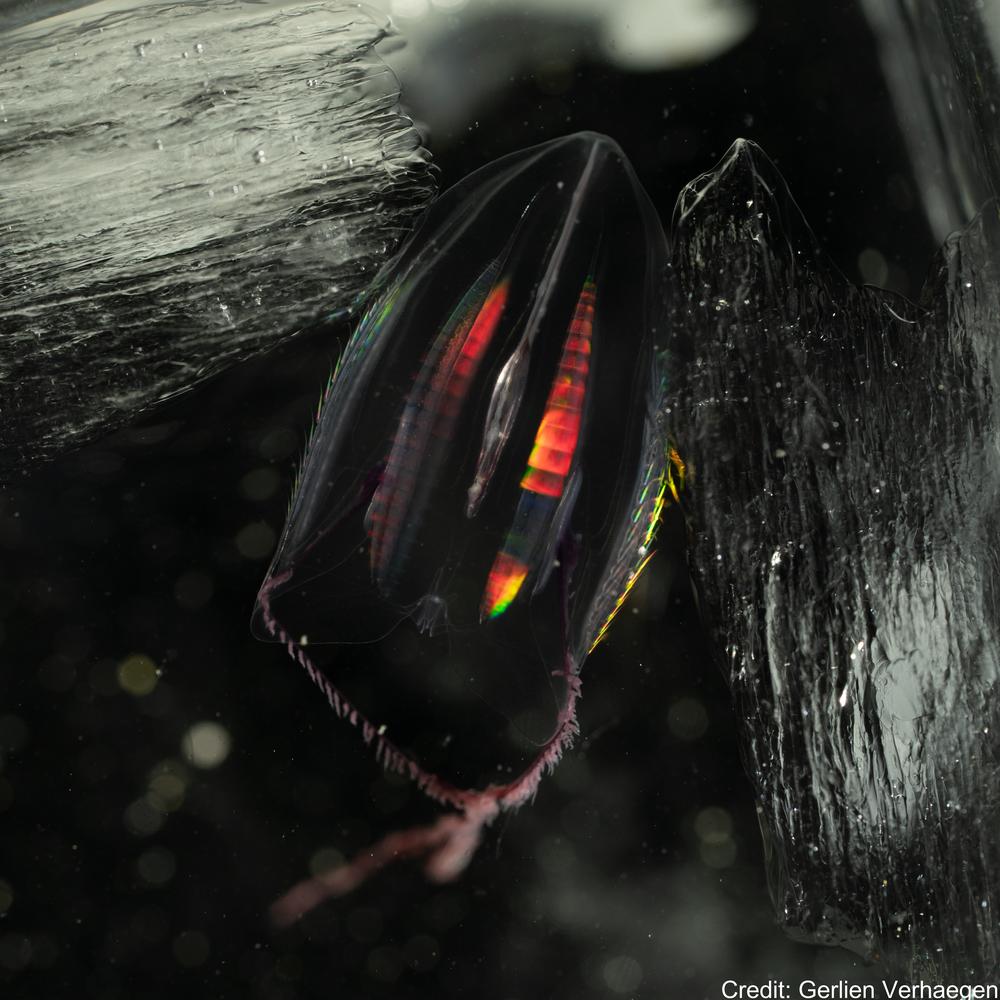
This Zenodo dataset contain the Common Objects in Context (COCO) files linked to the following publication: Each COCO zip folder contains an "annotations" folder including a json file and an "images" folder containing the annotated images. Verhaegen, G, Cimoli, E, & Lindsay, D (2021). Life beneath the ice: jellyfish and ctenophores from the Ross Sea, Antarctica, with an image-based training set for machine learning. Biodiversity Data Journal. https://doi.org/10.3897/BDJ.9.e69374 GET DATA: https://doi.org/10.5281/zenodo.5118012 GET DATA: http://ipt.pensoft.net/resource?r=life_beneath_the_ice-jellyfish_and_ctenophores_from_the_ross_sea_antarctica&v=1.3